Geography Of The Natural Home Cures Crystal Salt Himalayan Mountains
T he Himalayas, from the Sanskrit word Himalaya meaning "abode of snow", are a mountain system in Asia, separating the Tibetan Plateau from the Indian subcontinent. It is a broad continuous arc roughly 2,600 km; along the northern frontiers of the Indian subcontinent, from the Brahmaputra River in the east to the Indus River in the northwest. The Himalayan mountain range, averaging 320 to 400 km in width, emerges from the Gangetic Plain. To the north lies the Tibetan Plateau. The Himalayas form the world's highest mountain system, home to 9 of the 10 highest peaks in the planet. They are collectively known as the Eight-Thousanders, which includes Mount Everest (8,850 m/29,035 ft), and K2 or Mount Godwin Austen (8,611 m/28,251 ft). The Himalayan system stretches across six countries, namely Afghanistan, Bhutan, China, India, Nepal, and Pakistan.
Nineteen of the world's major rivers including the Brahmaputra, the Indus, the Ganges, and the Yangtze, originate in the Himalayas, and their composite drainage basin is home to an estimated 1.3 billion people. Physically, the Himalayas form three parallel zones of varying width, each having unique physiographic features and its own geologic history.
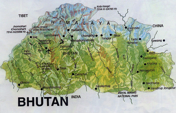
The Great Himalayas, the highest zone and the backbone of the entire mountain system, consists of a colossal line of snowy peaks with an average height exceeding 6,100 m/20,000 ft. It trends northwest-southeast from Jammu and Kashmir to Sikkim, an old Himalayan kingdom that is currently a state in India. East of Sikkim, the range goes east-west for another 420 km through Bhutan and the eastern part of Arunachal Pradesh as far as the peak of Kangto and finally turns northeast, terminating at Namcha Barwa.
The Middle Himalayas, also known as the Inner or Lesser Himalayas, possess a striking uniformity of height: most are between 1,830 and 3,050 meters. The Middle Himalayas region is an intricate cacophony of fertile valleys and forest-covered ranges. Within the Middle Himalayas, the intervening mountain ranges tend to separate the densely populated valleys. There are only a few roads and transport routes that exist between towns, partly because it is not financially feasible to build them over the rough terrain. Only major population centers are linked by air and roads with cities in India and Pakistan.
The Sub-Himalayas, which is the southernmost and the lowest zone, borders the plains of Pakistan North and India. It includes the Siwlik Range and foothills as well as the narrow piedmont plain at the foot of the mountains. A distinct feature of the Sub-Himalayas is the great number of flat-bottomed valleys known as duns, which are typically spindle-shaped and filled with alluvium. South of the foothills lies the Tari and Duars plains. The southern part of the Tari and Duars plains is heavily farmed. The northern part was a forest home to wild animals until about the 1950s. Most of the forests of this region have been exploited, and much of the land has been utilized for agriculture.
The Himalayas are greatly influenced by variations in climate and topography which can impose harsh living environments and tends to hinder movement and communication. The geographic variation is stunning with snowcapped mountains, jungles, and green vegetation landscapes throughout the regions.
